Saturday 30 November 2019

NCN54 Branston Locks Diversion

Approach to the school based on a wide shared path.
Although most of the National Forest cycling network is based in rural settings there are several built up areas including Burton, Swadlincote and Coalville.  All of these places have seen significant growth over recent years and one area of Burton is going through a particularly significant change which has had a major effect on the National Cycle Network (NCN).

The Branston Locks development is a large mix of industrial and residential development which covers a large section of land between Tatenhill and Shobnall, bordering the A38 and including the Trent and Mersey Canal.  NCN 54 formerly passed through this area as a quiet track called Anglessey Street.  Access to this lane has now been obstructed  by the development and an alternative route has been sought after by ourselves for some time.

Jim signing new entry from Shobnall Road to Callister Way
We discussed several routes around the development and finally had clearance to start signing a route earlier this year.  It is proposed for this route to have proper signage provided by Staffordshire County Council but until this is done we have signed it as best we can with our adhesive signs.

When the Branston Locks development is completed it should feature a number of different cycling and walking routes which could be adopted as NCN54 and hopefully this might follow the Trent and Mersey canal.

The route that has been replaced was good as it was flat, direct and in quite a peaceful rural setting, despite it's proximity to the A38 as it approached the Albion pub.  Whilst the alternative route goes through more built up areas, the vast majority of it is off-road on shared paths.  There are also a few eateries, shops and pubs on the route and it passes close to Branston Water Park.  Though it does intersect some busy roads most of the crossing points are Toucan crossings.

The initial route planning was done by our ranger Jim and after some discussion with one of our Network managers we agreed on a slight tweak.  The signing was done in 2 stages due to a shortage of signs and the need for a second look at one of the key areas within Branston village.

Description of the route (West to East - Tatenhill to Shobnall)

End of cycle route sign despite brand new path to Tatenhill
From Tatenhill, the route makes the most of a new path to John Taylor Free School which starts approximately 300 yards from the junction in Tatenhill.  For some reason this path is not signed as shared and not quite 3 metres wide even though it is clearly a safer alternative to the adjacent road.  The egress from the path in direction of Tatenhill is not ideal, which might be a reason for this.

At the end of the new path the route into Tatenhill is road based.
At the school there is a wide Toucan crossing which now carries the route safely across the road.  The route then follows a shared path through the car park and drop off zone, past the rugby club entrance and along Branston Road then onto Tatenhill Lane.  This shared path is continuous all the way to the Bridge Inn at the Trent and Mersey canal.  Clearly, during school run times, this area will be busy but should be quiet outside of the peak times.

At this point it is necessary to cross over the road and continue down Tatenhill Lane.  This leads to a dead end at the A38 and is relatively quiet though there is a new housing development under construction in this area.  Passage under the A38 is made via a shared path tunnel and there is a link to the nearby Branston Water Park.  The tunnel features some barriers to deter motor vehicles which may be tricky for certain bikes.

Hopefully the future route will feature a nice wide canal towpath
Once through the tunnel the route is on road but through the residential area around Branston Main Street before crossing the main road via a Toucan Crossing at Rykneld Primary School.  After another tricky barrier the route continues onto The Parkway - the main road into Burton from the A38 Branston exit.  At the junction by the Carvery restaurant and adjacent Steakhouse the route crosses the Parkway via a double Toucan crossing and subsequent further Toucan over First Avenue before continuing.

Safe passage under the A38 but mind the barriers.
New signage near canal-side Bridge Inn
The crossing at First Avenue features the most ridiculous cyclist dismount signs (aimed at deterring cyclists from cycling along the rarely used footpath along First Avenue).  They are around the size of a bank card but placed aloft a dedicated post - a completely unnecessary but no doubt significant on-cost to cycling infrastructure.  The picture below shows this, but you may struggle to see it.

Award for the most pointless dismount sign
One part of the new link which gave us cause for concern is the crossing at the roundabout of Second Avenue, near the Corner House and Holiday Inn Express.  Although there is a refuge and it is slightly away from the roundabout, there is no lighted crossing and the roundabout is busy with a 40mph speed limit.  During our check of the signing there were roadworks in place here with the inevitable cyclist dismount signage!

Once over this road the shared path continues along Parkway, crossing Third and Fourth Avenue before a relatively long section to Callister Way roundabout.  Whilst the path is wide, there are sections of vegetation which protrude significantly in some places.

Vegetation narrowing the path!.
At Callister Way the route turns away from Parkway and heads over the Trent and Mersey Canal and through an area yet to be developed, onto an off-road section which rejoins the old section of NCN 54 on the other side of the A38 from the Albion pub close to the Marstons brewery.

The new route will take slightly longer than the old route, perhaps around 20-25 minutes without stopping but does feature a lot more in terms of refreshments and facilities.

We will continue to monitor the new route and also intend to look at routes around Burton next year amongst several other areas.  We'll also be keeping an eye on how the Branston Locks development progresses and ensure that the infrastructure is of NCN standard.


Thursday 28 November 2019

Bikes on Trains - the debate goes on.

The subject of cycling is one of many debated daily through many social media channels.  Social media certainly provides an outlet for debate; often for frustrations and occasionally some praise!

One recurring theme is about being able to take bikes on trains.  This is often debated on the Facebook page for the National Cycle Network but a recent tweet certainly ignited the debate once more and I feel compelled, albeit with delay, to comment on the events.

We've discussed the issues with taking bikes on trains on this blog.  My experience of taking my bike from Burton to Stafford was ok but there were a few issues even on a short journey as the blog item explains.

Another blog post recently discussed mobility cycling and the fact that bikes are a mobility aid and vital to people who may not be able to walk long distances.

One item that certainly provoked response on Facebook was when LNER (who operate the East Coast Mainline from Kings Cross to Leeds, York, Newcastle and Edinburgh amongst other places) announced the arrival of the new Azuma train.  The Azuma has been brought in to replace an ageing fleet of diesel 125 trains and electric 225 trains.  A similar thing happened on the GWR network from Paddington to South West destinations too.

Whilst the new trains are an improvement in many aspects it is noted that in terms of cycling space they lack the spacious facilities of the 125 which had a large guard's van and the 225 which had a large driving van trailer.

As the poster shows, there is only space for 4 bikes on a 10 coach train and 2 on a 5 coach train on the Azuma.

The type of storage adopted typically used now requires the user to lift the bike up and suspend the bike from a hook mounted high.  This is mainly due to spatial economy.

125s have provided good bike storage since the 1970s
The problem with this is that it is not often easy to fit bikes when fully loaded with panniers (for those travelling long distances) and there is certainly no space for other adapted bikes or tandems.  Whilst I'm not particularly strong I'm fit and able to hang my bike.  Unfortunately not everyone is.  I mentioned above about bikes being a useful mobility aid but not everyone capable of riding a bike is physically capable of lifting a bike.

When browsing Twitter fairly recently my attention as drawn to an issue involving Cross Country trains.  A passenger had tweeted to ask about help to hang the bike as they knew they were not physically strong enough.  It is also not easy to locate someone to help hang the bike on the train and it can be very tricky when a train is crowded, which they often are.  The final response from Cross Country as shown is extraordinarily disappointing in a number of ways and does not inspire confidence, especially as Cross Country are the only operator from Burton on Trent.  Whilst Health and Safety are paramount, the tone of the response is poor. 

It's not all doom and gloom though, as Scot Rail are making some alterations to some older trains on the West Highland Line which is a popular tourist line and popular with cyclists.  More information can be read by clicking here.

It is difficult to see any significant improvement forthcoming on the railway network in the near future but the lobbying needs to continue and hopefully longer term the picture will change.

Tuesday 26 November 2019

Paths for Everyone - a new perspective - review of Sustrans GC Conference

In September the Sustrans Volunteer Group Coordinators conferences took place in York and Reading.  I took the chance to go to the northern event in my home city of York.  These events are very useful for networking and I'd not had the chance to do this with volunteers from Yorkshire and the North East much.
Micklegate Bar - York

The event took place a short walk from York Station so it saved me the anxiety of trying to book my bike onto the train.  In order to make the trip as cost effective as possible I'd booked split tickets from Burton to Chesterfield and Chesterfield to York due to subsidies through Yorkshire. The reservation system was on the blink but fortunately this didn't cause a problem. Thankfully the train was on time and delivered me to York in a relaxed state on a nice late summer day.

The event itself was well attended with rangers mainly from the north, including Merseyside, Leeds, Tyneside, Northumberland and Scotland.

The notable part of the presentations was a talk by Xavier Brice, CEO of Sustrans.  One of the main themes was to show how important the volunteers are to an organisation like Sustrans and several examples were given.  Mention was made of the recent £21 million given to Sustrans to develop parts of the National Cycle Network and some of the adverse feedback given.  Whilst it is only a small fraction of the amount needed for the whole network it is still a significant figure.

The theme that everybody wanted to hear about was the update on the upgrade of the National Cycle Network - known as Paths for Everyone.    There was an update on standards required going forward and also some discussion on potential de-classification of sections that are classified as poor.  I'm sure there will be more on this particular subject going forward.

The latest update on paths for everyone can be found here.

The other part of Paths for Everyone is ensuring that the network is accessible for all and this involves the removal of barriers from the routes.  There are 16000 in total, so this is a significant challenge.  The first of the workshops attended dug a little deeper into this topic and provided some new perspectives.

A local company called Get Cycling had been invited to show some mobility bikes, whilst a member of the ramblers association brought a tramper along.  The introduction to the workshop was given by Jim who explained the aims of Get Cycling and in particular his own personal story of wanting to be able to take his son cycling but needing adapted equipment to be able to do so.  You can learn a lot more about Get Cycling by clicking here.

The bikes are bought in places like the Netherlands and Germany and refurbished and sold at lower prices than new.  One of the key points that Jim made which really resonated with me was that the speciality bikes are seen as very niche in the UK but in those countries with more developed cycling infrastructure they are much more common place.  Whereas in the UK they would be used mainly for infrequent leisure trips, in other places they are part of everyday life and a necessary part of getting around.

We were encouraged to use the bikes and the tramper to get an idea of how they handle and we were given an insight into adaptations specifically made for certain disabilities.  The point was also made about bikes being an important aid to mobility in general - and how poor infrastructure and barriers in particular can be critical - not all users can lift bikes over obstacles.

The day also featured discussions on successful led rides, attracting funding for small projects and the day ended with a nice social walk around York.


Back in Swadlincote, fresh with inspiration I revisited an area of concern on one of the new developments that will be part of NCN 63 in the future as the network is completed.  I had noticed the installations of some inappropriate barriers and reported this to the planning department at South Derbyshire District Council.  The barriers were so close together that it was only possible to get a bike through - even a normal sized wheelchair or a double buggy would have struggled to pass.  To be fair, although the barriers are still there, they have been amended and are not so ridiculous tight.  The funny part, as the picture shows, is that one set of the barriers are easily passable to the side.

See how close the barriers were!
Whilst the issue has been resolved to some extent it is concerning that new sections of NCN created through development feature these obstacles that are clearly not in the new vision.  Clearly, some form of best design practice needs to be communicated and implemented in order for the NCN to truly be considered as paths for everyone.


Saturday 25 May 2019

Problems on new surface of NCN63

Our recent Spring update featured news of the new surface of route 63 between Donisthorpe and Measham.  In the article it was mentioned that there were areas where there were loose stones.

We have received a few comments and complaints about this section as the surface has not bedded in as well as hoped.  Leicestershire County Council are aware of the issue and are trying to find a solution.  In the meantime we advise that users take care when using the sections affected.

Further updates will be posted when available.

Sunday 19 May 2019

Spring update

The arrival of Spring normally heralds an increase in activity out on the National Cycle Network and the recent heatwave over the Easter weekend will have helped.

NCN63 approach to Donisthorpe 2017 vs 2019
More recent weather has shown how important maintaining the surface of the network is.  This year we are pleased to share the news that improvements have been made to a significant section of our local network in the form of resurfacing of NCN63 on the Ashby Wolds Heritage Trail between Donisthorpe Church and Measham.

NCN63 approach to Oakthorpe 2017 vs 2019
The work has been carried out by the local ranger team from Leicestershire County Council and has taken the form of a new stone surface which has been rolled. This follows some work last year on the verges surrounding the path.

Whilst the surface is quite loose in places initially, with use and weathering the path surface should improve in the future.  Pictures taken before and after in 2 locations show how significant the improvement is with the surface.  We look forward to monitoring the surface as part of our route checks over the coming months and years.

Away from our local area we noticed that there are some new leaflets relating to cycling further north in Derbyshire - namely the Peak District.  We have posted articles about some of the trails in the Peak District and these leaflets feature some of those trails.  Based around the main towns including Ashbourne, Bakewell and Matlock there are 4 leaflets which include several different routes in some detail.  The leaflets are all available in Swadlincote Tourist Information Centre at Sharpes Pottery.

On a recent visit to the TIC I was informed that the cycle hire centre at Hicks Lodge now includes e-bike hire.  For more information click here for a link to the Hicks Lodge Cafe / Bike Hire company page.

We have several activities planned over the next few months including signage work in Burton to divert NCN54 away from a major development site, continual monitoring of new link to Hicks Lodge from Moira Furnace.  We will be involved in another led ride from Maurice Lea Park in the summer amongst other activities.


Friday 15 March 2019

Local integration with the railways

The National Cycle Network features a lot of off-road routes that were formerly railway lines, indeed the first section of Sustrans path was a railway between Bristol and Bath.  Although the most recent version of Sustrans aims removed the statement relating to public transport to concentrate on walking and cycling, there is still much to be achieved by integration of all three.

This article looks at that integration from a local perspective, with several recent events and articles providing an interesting backdrop.  Local routes 6, 54 and 63 within the National Forest area all feature former railway lines.

Other than Burton, the only 2 railway stations within the area are Willington on the Derby to Birmingham line and Hatton on the Derby to Stoke line.  North West Leicestershire has no stations but has the currently freight only Ivanhoe Line (Burton to Leicester) which runs alongside part of NCN63 near Church Gresley - more of that a bit later.

Another line planned to traverse North West Leicestershire without serving it directly is High Speed 2 (HS2).    This article does not intend to discuss the pros and cons of High Speed rail.  There has been much debate over the benefit of HS2, particularly in communities closest to the line.  Those personally most affected will receive forms of compensation but the communities in general tend to look towards mitigation in terms of legacy projects that aim to improve the area once the line is built.

One such legacy factor for HS2 was a network of proposed cycleways which in terms of benefits versus investment would actually have provided better value for money per person than HS2 itself whilst working along side.  Sadly, this appears to be an opportunity missed as this article from the Guardian explains.

HS2 is not the first major infrastructure project to pass close to Measham.  The A42 was built in the early 1990s to link the M1 with the M42.  Unlike the later A50 route which feature tunnels carrying cycle routes notably the former railway lines carrying current NCN routes 63 and 6 were left curtailed by the A42, hence the diversions from the original route around the thunder of the A42 at Measham and close to Breedon.

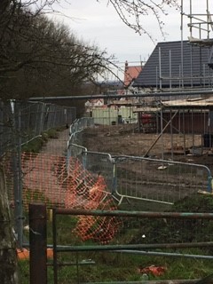
Next to the Conkachoo - a rare passenger train in NW Leicestershire!
A similar situation applies to the Ashby Canal whose original and proposed new routes would pass under the A42 and HS2 proposed route.  This leaves a pair of expensive obstacles to completion of the canal project.  The realignment of the A42 around Measham for HS2 sounds like an ideal opportunity to make provision for the canal while realignment work is done rather than an expensive retrospective engineering solution.  However HS2 does not recognise the Ashby Canal project as significant enough to include provision. From the perspective of the local economy this is unfortunate to say the least.

HS2 is not the first project to destroy the peace and tranquillity of an area of beauty.  When the Derby-Bakewell-Buxton-Manchester midland main line was built through the Monsal Valley there was uproar.  Back in 1863 art critic and culture writer John Ruskin believed the railway completely destroyed the valley.

The link with the railways is often obvious
These days the railway trackbed carries the Monsal Trail, one of the most popular cycle routes not only in the Peak District but in the country.  The views from Headstone Viaduct are tremendous and the trail is an exceptional experience as this blog item from 5 years ago explains.  As the above paragraph alludes to though the trail is in place of what was a major piece of railway infrastructure and there has been a level of support to reinstate the railway.

Could cycling and railway exist side by side here?
There have been concerns that losing the Monsal trail would be a major in terms of lost cycling and walking infrastructure - currently the line itself is a destination as opposed to a route between other destinations such as Bakewell and Buxton.  Can the railway and cycle & walking infrastructre work together? - you'd have to say this would be unlikely due to the geographical and geological nature of the route but it is worth investigating due to the significant visitors to the area (300k annually) based on the current attraction.  Despite the potential for loss of the current trail cycling groups do not necessarily oppose the re-opening.

Further down in Derbyshire, sandwiched between East Staffordshire and North West Leicestershire is the Ivanhoe line mentioned near the start of the article.  Unlike the Monsal Trail there is no risk to the adjacent cycle tracks; the line is still operational but generally needs upgrading from its current freight only quality to passenger services including several new stations.

The initial concept for the line was a large circular route via Loughbrough as explained here on Wikipedia.  The area of interest here is between Leicester and Burton as explained in this Wikipedia page.

The main aims of the line would be to reduce the traffic into Leicester from the Ashby/Coalville corridor, estimated at around 4000-6000 journeys per day.  It would also provide a link to the Heart of the National Forest so provide a useful piece of tourism infrastructure.  Several attempts have been made to reopen the line.

In 1992 the cost was estimated at £16 million.  Stage 1 was implemented but not the whole route.  Privatisation in 1995 then affected the proposals further so the project was put on hold.  Further proposals in 1997 and 1999 were unsuccessful and by 2009 the cost had risen to £50
The Ivanhoe Line features in this report.
million with estimated subsidy required of £4 million per annum or the building of an extra 268000 houses to provide patronage for the line.  These figures have been contested and continue to do so while passenger numbers rise.  The Association of Train Operating Companies (ATOC) had stated that the cost to benefit ratio was positive.

As each new proposal is discussed the number of stations appears to become lower.  Originally a station at Moira was planned but this now looks to have been omitted, making Gresley and Ashby the closest to the Heart of the National Forest area.  A pressure group called Campaign to Re-open the Ivanhoe Line (CRIL) has been formed and a report from the local press explains more here.

Proposals are not strictly limited to the Burton to Leicester section and may incorporate Lichfield via the National Memorial Arboretum.  It will be interesting to see what progress will be made this time.  Whilst funding, cost of fares and co-operation between Leicestershire, Derbyshire and Staffordshire County Councils are still significant hurdles, the fact that the line appears fairly prominently in the Campaign for Better Transport report "Case for Expanding the Rail Network" which can be read here.

Our aspiration from the proposal, if it comes to fruition, would be to ensure that the re-opened stations would be part of good quality transport links including cycling along the route and that being a tourist destination that the rolling stock provides decent capacity for bikes.  The blog has reported in the past on the inconsistency of service provided regarding taking the bike on the train as this link explains.  Hopefully if or when te line re-opens to passenger traffic the cost of tickets and complexity of finding the cheapest tickets won't be as much of a challenge as they are now.

Regardless of the Ivanhoe, or National Forest Line there is still some work to be done regarding integration with other transport at Burton-on-Trent station.  Recently we reviewed the links to and from Burton Station to the NCN and the approach to the station is far from ideal.  Another problem with onward connection from Burton, particularly to Swadlincote and surrounding villages, is the lack of buses that pass and stop at the station.  This is understandable given the precarious nature of the flow of traffic into, out of and within Burton.

Most bus services to Swadlincote depart from New Street which is a brisk 15 minute walk from the station.  The road layout near the station is currently not conducive for an interchange type arrangement although some significant work is taking place there this summer.  We're not sure of the details of the work but hope it can improve both local transport connectivity and cycling access to and from the station.  Read the link to the planned roadworks near Burton Station here.

We will monitor developments closely over the coming months and years.  There are some potentially large and exciting developments if things are done well.  Hopefully there will be some improvement in connectivity to improve our growing off road cycling and walking network.


Monday 28 January 2019

Early 2019 news

Our first route checks of the year were done early due to a relatively mild start to 2019.  Our local National Cycle Network sections between Church Gresley and Moira are looking in decent condition thanks to a largely dry 2018.

We've benefited not only from our own work and those with the payback teams but we're also lucky to have several other groups that have done some very good work around parts of the network .  On the Ashby Wolds Heritage Trail embankment in Moira the ranger team and volunteers have done more work on thinning the vegetation around the path which will reduce the amount of vegetation which mulches on the path.

Further round the route the volunteers of the Ashby Canal Trust and Moira Furnace museum have done some good work on the paths and banks of the canal sections and seen significant improvements.

The sections descending to Albert village lake from Reservoir Hill were starting to get overgrown and almost restricting the path to single file in parts but have now been pruned and tidied by teams engaged by the National Forest Company.  Again it looks so much better and should remain so for several months.

A small section between Swainspark Wood and Spring Cottge could benefit from a sweeping back of vegetation so hopefully we'll arrange a session on there soon.

We'll be looking at the sections towards Measham in the near future too.

As well as looking after our current sections we are also glad to report on future links.  Although the link to Hicks Lodge from Moira Furnace is not an NCN route we will certainly be signing links to and from the NCN from it.  The final section of this link is close to completion as is the housing estate that carries it.  Our only concern is the crossing of Measham Road as we have noticed speeding there and there is no specific crossing as development money has been spent elsewhere.  As the road is straight with good visibility it should not be too much of an issue  but a crossing would have been useful.

Once the link is completed we will sign it from the Conkers and Furnace area.

A few miles away in Swadlincote the new community fire station is nearing completion and this will feature a new access from Civic Way behind the fire station onto the quiet Toulmin Drive to Darklands Road rather than down the unsuitable and ambiguous shared path down Civic Way.

The old council depot on Darklands Road now has planning permission for a KFC restaurant, a family pub and some sheltered accommodation and the entrance to this will cross NCN 63.  We were concerned about the lack of information about the route of the path around the development and this was addressed following the submission of our comments.

Further down William Nadin Way the latest development has been approved and initial work has started.  This will carry the next stage of NCN63 towards Newhall, then Burton.  The neighbouring development carries a section of path which currently ends on the boundary but will be linked with the new development.


Monday 21 January 2019

Recording Camera footage with Derbyshire police

Although most of our activities take place on off-road sections of the cycle network and we focus on the positive of safe family cycling, we all cycle in places where there is a certain level of traffic and risks associated with that.

Whilst most drivers behave very well and give cyclists and other drivers plenty of room there are occasional moments of inconsideration and sometimes this includes speeding, aggressive driving and other illegal manoeuvres.

Dashcam footage is becoming an increasingly popular source of evidence in terms of behaviour on the roads and cyclists are also choosing to carry cameras on bikes.  Nationally there is an inconsistent approach to how the evidence is handled but Derbyshire Police have launched a new system called Derbyshire Capture which is a specific place for downloading dashcam and digital images relating to a road based crime.

As the site says: Derbyshire Capture will investigate offences of dangerous driving, driving without due care and attention, careless driving, using a mobile phone, not wearing a seat belt, contravening a red traffic light, contravening solid white lines, and other offences where the driver is clearly not in proper control of the vehicle.

Click here for a link to the Derbyshire Police website page which will give links to Derbyshire Capture and also gives a list of advice and conditions relating to the site.  For example it advises not to put the footage on social media.  The system can also be used to report dangerous cycling too.  There are a crazy amount of people on bikes after dark with no lights on - a worryingly increasing trend.

I found out about this via an email to Derbyshire alert which informs me of any alerts relevant to my area in South Derbyshire.  If you are interested in subscribing or want to learn more have a look on the Derbyshire Alert website.  Click here to go to the Derbyshire Alert website.